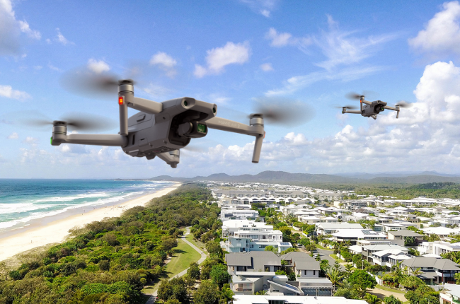
As explored in Part 1 of this two-part series, more and more councils across NSW are using drones for a range of purposes. And many of these councils are choosing to build drone capabilities in-house – rather than outsource to contractors.
That’s why Statewide Mutual is dedicated to helping its members navigate compliance challenges and establish best-practice risk management procedures.
One of the ways we achieve this is through our partnership with AVCRM and our joint annual competition. Here, we take a look at this year’s winners and what they’re setting out to achieve.
Providing commentary on the winning projects is Isaac Palmer, National Operations Manager of AVCRM.
The AVCRM-Statewide Mutual 2020 Awards
We asked councils across NSW to fill out a 500-word form detailing the innovative new ways they could use drones within their organisation and the resulting benefits.
“We were absolutely blown away by the standard of entries. It certainly made choosing a winner a challenge.
“When we ran the competition last year, we only had one winner. But with so many outstanding entries this year, we decided to have three tiers of winners: 1st Prize (Major), 2nd Prize (Runner-up) and 3rd Prize (Minor),” he said.
The prizes for each category were:
- 1st Prize (Major): A top-of-the-range fully thermal drone, full certification and training (value <$12,000)
- 2nd Prize (Runner-up): A top-end drone plus a full training package.
- 3rd Prize (Minor): A mid-range drone and a full training package.
Major Winner: Fairfield City Council
Before winning their drone package, Fairfield City Council was accessing drone technology through contractors. They used these third-party services to capture video footage of new or improved assets – and large events, such as New Year’s Eve celebrations.
However, the council said that if they had drone capabilities in-house, they would integrate drones into almost every aspect of their operations.
Some of the intended uses they outlined included:
- Inspecting roofs and solar panels more safely: Currently, Council needs to have staff trained in working from heights and elevated work platforms to complete these inspections.
- Conducting contactless inspections: At the moment, pool, house, industrial, bridge and tree inspections are carried out in-person by staff. But with the COVID-19 pandemic, onsite visits have not been an option. With drones, however, inspections can be carried out from a safe distance.
- Creating 3D mapping of city centres and other infrastructure: This drone work would help Council plan new infrastructure by mapping traffic and pedestrian movements.
- Improving construction projects: Council would use drones to access real-time mapping as part of the planning and construction phase of their infrastructure projects. This would identify potential issues and provide accurate measurements quickly and cost-effectively.
- Conducting lidar inspections: Drones could be used to map vegetation and terrain over large areas that are difficult to inspect and view, such as bushland. Council could then determine the percentage of tree canopy, as well as changes in terrains after natural events or the installation of new infrastructure.
- Creating marketing content: Council is continually delivering new and impressive infrastructure and events. Drones can capture footage for promotional purposes.
Runner-up: Narrandera Shire Council
Before the competition, Narrandera Shire Council was barely using drones – with staff using their personal drones for inspections and other internal tasks.
Generously, the council said that if they were to win, they would share the drone with neighbouring councils. The main uses outlined in their competition entry included:
- Inspecting roofs: Council would use drones to ensure roofs are structurally sound before storms, so that they could make any necessary repairs before the event.
- Inspecting water towers: Drones could check that a water tower is structurally sound and free of faults without a worker having to climb to the top – or needing to hire an elevated platform.
- Inspecting landfill areas: Using thermal imaging, Council could inspect landfill areas to check for potential underground fires (reducing the risk of public liability claims and fines from the EPA).
- Inspecting roadworks signage. Drones could be used to ensure all signage is displayed and positioned correctly according to traffic control plans.
- Assessing stock quantities in quarries: Volumetric surveys would quickly and efficiently report how much raw material remains in the quarry.
- Identifying weeds: Drones could reach areas that are not easily accessible to arrange precision weed spraying.
Minor Winner: Dungog Shire Council
Judges were particularly impressed that this council asked its some-68 staff for ideas on how drones could benefit Dungog Shire’s work.
Some of their suggestions included:
- Conducting volumetric surveys of the Dungog Waste Management facility: These surveys would assist in preparing Council’s six-monthly volumetric surveys for the EPA.
- Surveying illegal activities in remote areas: Drones could be used to survey remote locations and assess whether illegal activities (such as prohibited camping and vegetation removal) were taking place. This is much safer than lone workers surveying or confronting people directly.
- Surveying timber bridges: Drones could check the structural integrity of timber bridges.
- Obtaining tourism and promotional footage: Council could use drones to capture footage of Dungog’s natural assets to promote the local area.
Want to use drones for any of the activities mentioned in this article?
If your council is looking to set up its own drone team, Isaac says that the best place to start is either with your Statewide Mutual Risk Manager – or AVCRM.
Thanks to Statewide’s partnership with AVCRM, your council will receive FREE expert advice and a tailored plan.